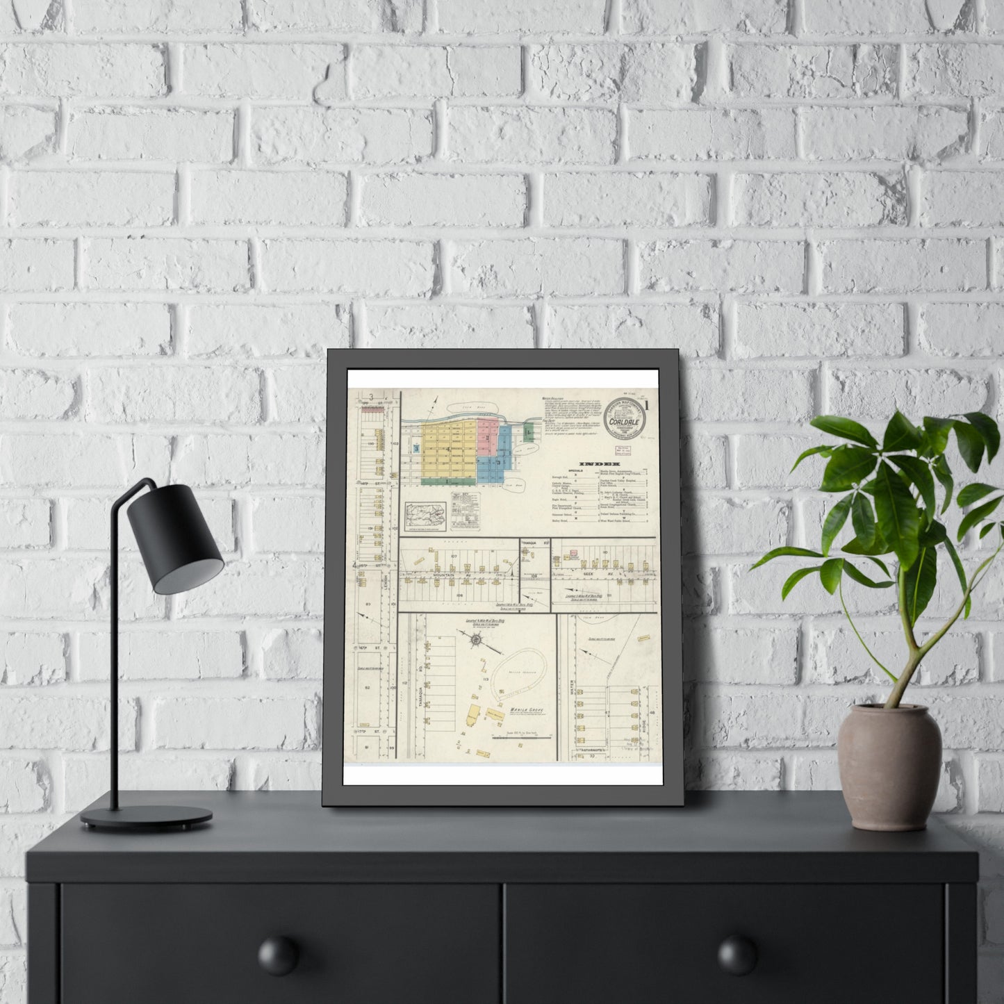
Large-scale (typically 1:600) fire-insurance maps of Coaldale showing every building's footprint, construction material, use, street numbers, and businesses. 4 editions span 1916-1940 (2 digitized and online at LOC). The best source for downtown and property history. Each edition is also cataloged as its own record.
Look for: Coaldale, Panther Valley.
Printed to order on archival, acid-free matte stock with a small white border for easy framing. Reproduced from a high-resolution public-domain scan.
Your purchase supports the free Schuylkill County map archive at schuylkillhub.com.
Source & credit: Sanborn Map Company. Coaldale, Schuylkill County, Pennsylvania, 1916-1940. Library of Congress, Geography and Map Division, Sanborn Maps Collection.