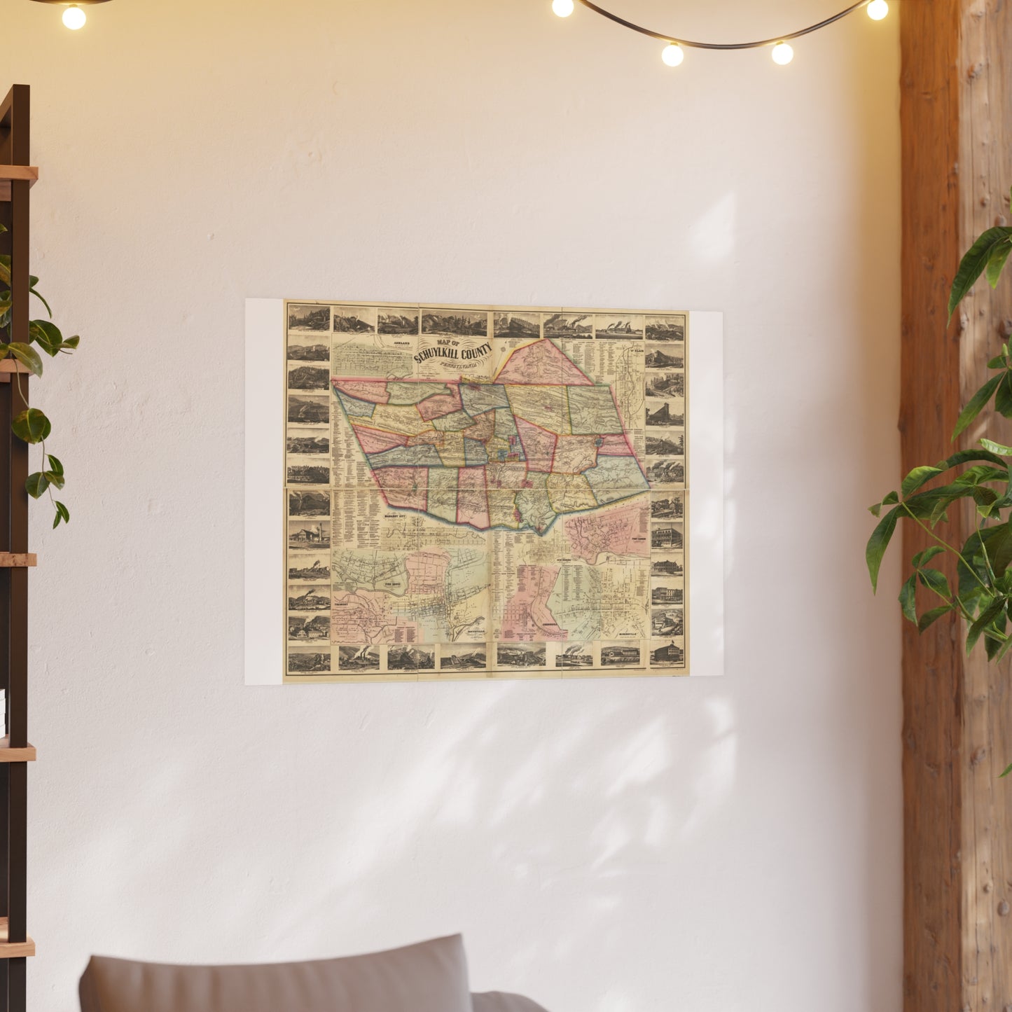
A large (114 x 126 cm) hand-colored wall map from actual surveys by Walter Scott and W. J. Cox, published by James D. Scott. Includes detailed borough insets for Ashland, St. Clair, Port Carbon, Orwigsburg, Minersville, Cressona, Pottsville, Pine Grove, Tremont, and Mahanoy City, plus borough business directories. A centerpiece Civil-War-era view of the whole county.
Look for: Pottsville, borough insets, business directories, collieries.
Printed to order on archival, acid-free matte stock with a small white border for easy framing. Reproduced from a high-resolution public-domain scan.
Your purchase supports the free Schuylkill County map archive at schuylkillhub.com.
Source & credit: Scott, Walter, and W. J. Cox. Map of Schuylkill County, Pennsylvania: From Actual Surveys. Philadelphia: James D. Scott, 1864. Library of Congress, Geography and Map Division.