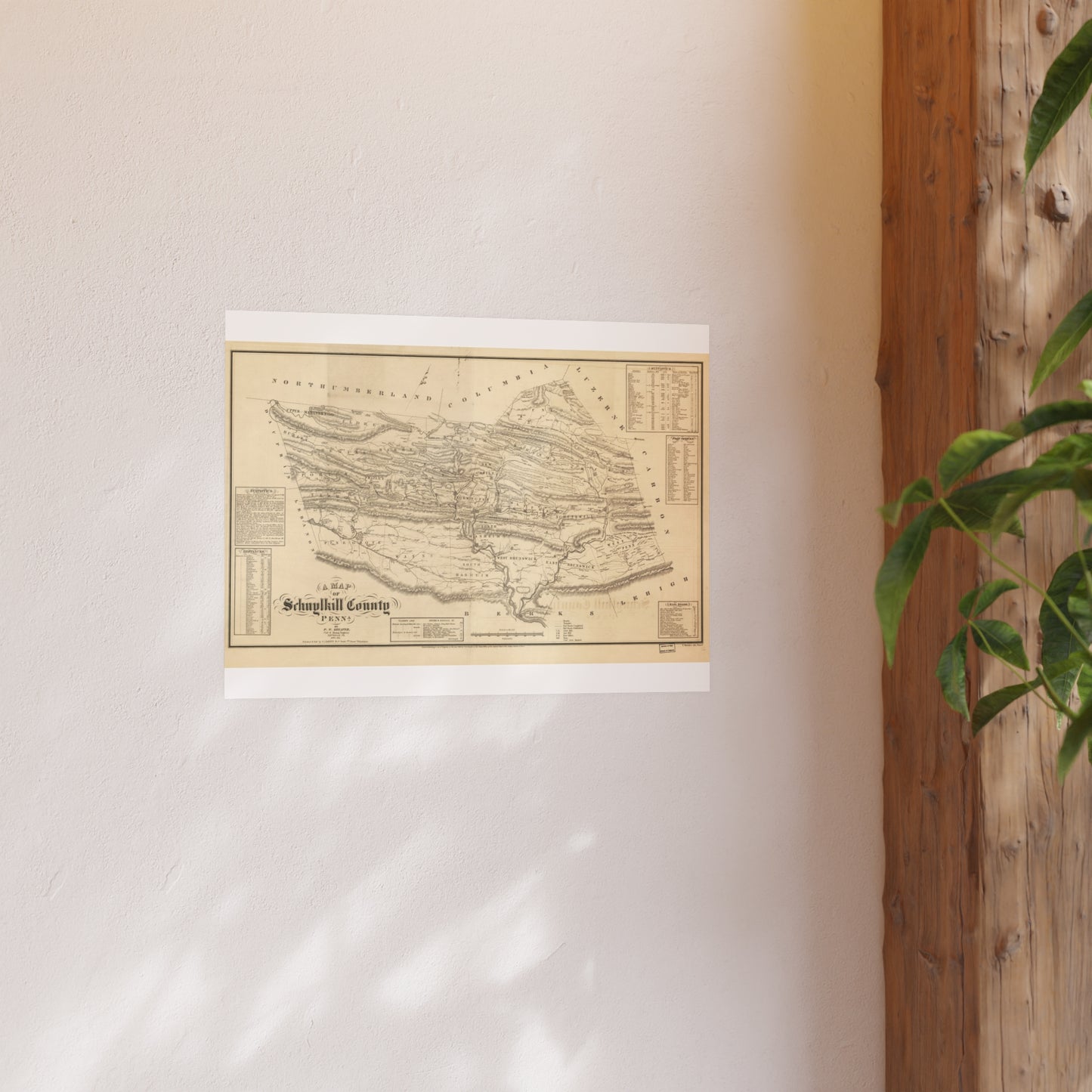
A detailed mid-century county map compiled by P. W. Sheafer (the noted anthracite-region geologist and surveyor) and published by R. L. Barnes. Predates the railroad-map era and captures the county at the start of its industrial expansion.
Look for: Pottsville, townships, early collieries, turnpikes.
Printed to order on archival, acid-free matte stock with a small white border for easy framing. Reproduced from a high-resolution public-domain scan.
Your purchase supports the free Schuylkill County map archive at schuylkillhub.com.
Source & credit: Sheafer, P. W. A Map of Schuylkill County, Penna. Philadelphia: R. L. Barnes, 1855. Library of Congress, Geography and Map Division.